


India – State Boundaries Map in Editable PowerPoint Vector
Original price was: $39.95.$29.95Current price is: $29.95.
India – State Boundaries Map in Editable PowerPoint Vector
Introducing exceptional vector maps for PowerPoint, crafted to depict the boundaries of the Indian States. These vector maps empower you to create impactful presentations that resonate with your audience.
Precision:
- Leverage the power of vector graphics for crisp, clear boundaries that won’t pixelate when scaled.
- Zoom in and out with confidence, maintaining perfect clarity for any presentation size.
Effortless Customization:
- Tailor the map to your specific needs. Change colors, add labels, or highlight specific areas effortlessly.
- Ensure your map aligns perfectly with your presentation’s theme and branding.
Engaging Storytelling:
- Capture your audience’s attention with a visually compelling map
- Communicate geographical data effectively, leaving a lasting impression on your viewers.
Invest in these superior vector maps and elevate your presentations to a whole new level.
Available in editable PowerPoint format for seamless integration into your existing slides.
Download a free sample file clicking here and see how vector maps work
Don’t forget to hit “Enable editing” in your PowerPoint to start editing
![]()
Description
India – State Boundaries Map in Editable PowerPoint Vector
Introducing exceptional vector maps for PowerPoint, crafted to depict the boundaries of the Indian States. These vector maps empower you to create impactful presentations that resonate with your audience.
Precision:
- Leverage the power of vector graphics for crisp, clear boundaries that won’t pixelate when scaled.
- Zoom in and out with confidence, maintaining perfect clarity for any presentation size.
Effortless Customization:
- Tailor the map to your specific needs. Change colors, add labels, or highlight specific areas effortlessly.
- Ensure your map aligns perfectly with your presentation’s theme and branding.
Engaging Storytelling:
- Capture your audience’s attention with a visually compelling map
- Communicate geographical data effectively, leaving a lasting impression on your viewers.
Invest in these superior vector maps and elevate your presentations to a whole new level.
Available in editable PowerPoint format for seamless integration into your existing slides.
Download a free sample file clicking here and see how vector maps work
Don’t forget to hit “Enable editing” in your PowerPoint to start editing
![]()
You may also like…
-
- Sale!
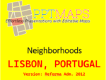
- Neighborhoods
Lisbon, Portugal – Neighborhoods in PowerPoint Vector
- Original price was: $29.95.$24.95Current price is: $24.95.
- Add to cart
Reviews
There are no reviews yet.